Downdraft CAPE
What goes up frequently comes down, sometimes with disastrous consequences.

CAPE, or Convective Available Potential Energy, is an important indicator of the potential for strong convective energy to initiate the formation of thunderstorms. CAPE is primarily concerned with air parcels going up, but the converse of that are air parcels falling. This brings up the opposite of CAPE, downdraft CAPE.
 Keith R Thompson, WeatherHawks
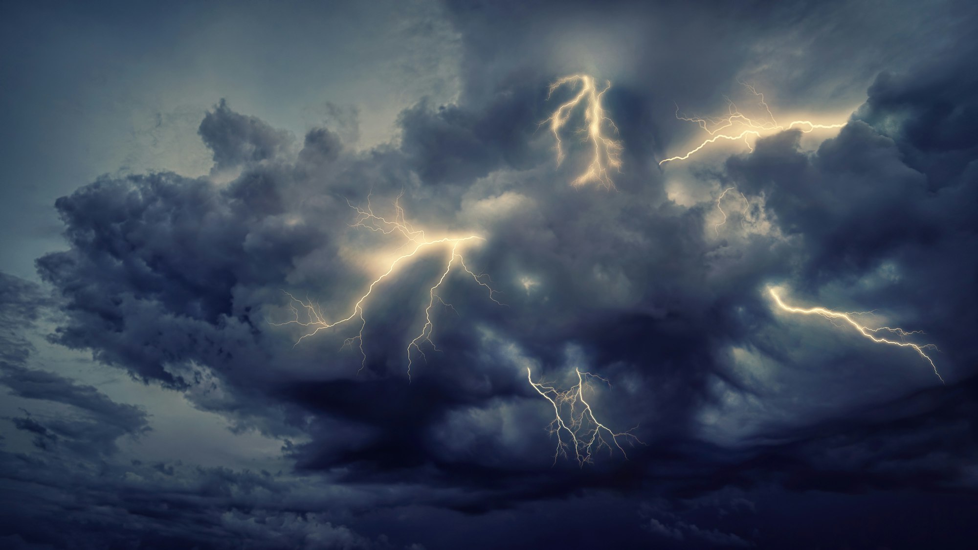
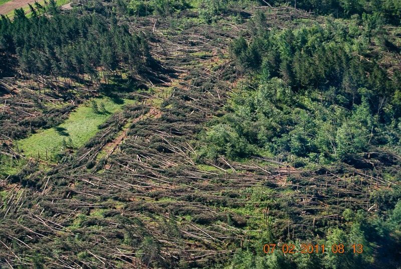
Downdrafts from thunderstorms can reach 100 miles per hour and cause damage or destruction over a 100-mile-wide area. These bursts of high winds can also pose a threat to landing aircraft when they are low and slow in the final phase of their landing approach.
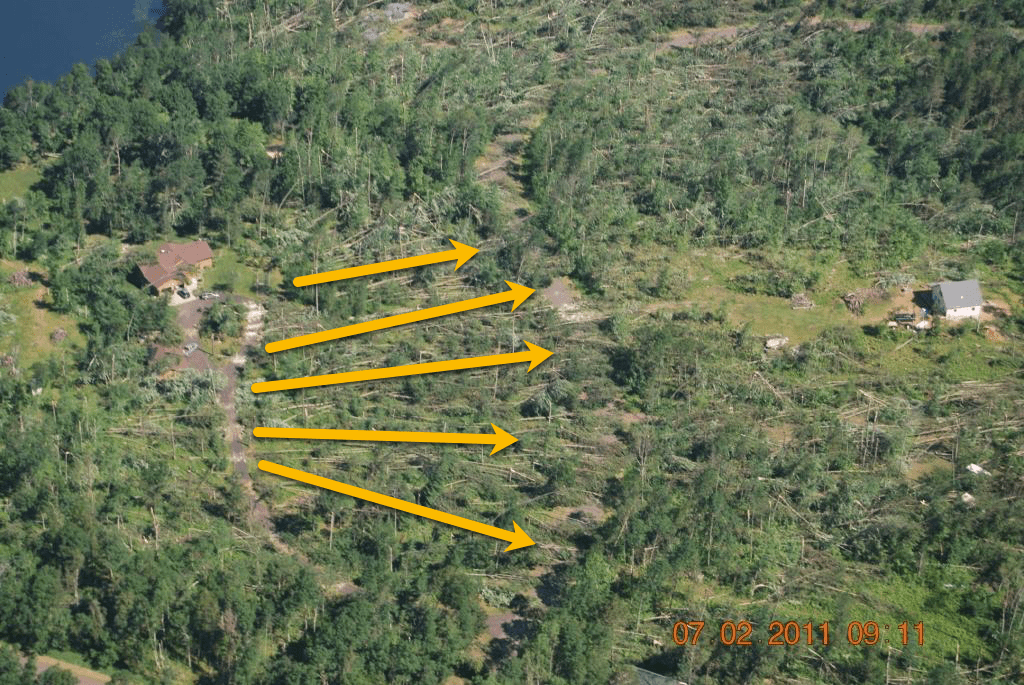
Downdrafts occur when a column of rain is falling through the core of a thunderstorm. This rain will drag some of the surrounding air down with it, a process known as entrainment. Some of this falling moisture will evaporate and cool the drier air on its periphery. This cooler, drier air is now denser and will begin to fall, sometimes quite rapidly. When it hits the ground it spreads out in all directions, like water from a faucet when it first hits the bottom of the sink. These winds are known as straight-line winds and can be one of the most dangerous, damaging aspects of a supercell thunderstorm. Damage from straight-line winds is sometimes mistaken for tornado damage, but the consistent alignment of downed trees gives it away.
The cooler this descending air is relative to the surrounding atmosphere the greater the potential for significant downdrafts. This temperature difference, along with relative humidity, is used by meteorologists to calculate Downdraft CAPE. This value gives forecasters an indication of the potential strength of rain-cooled downdrafts within thunderstorms.
Downdraft CAPE, or DCAPE, is the maximum energy available to a descending parcel of air. The higher the value of DCAPE, the stronger the downdraft potential. Values of DCAPE greater than 800 joules/kilogram (J/kg) are decent values, while values exceeding 1200 J/kg are very high.
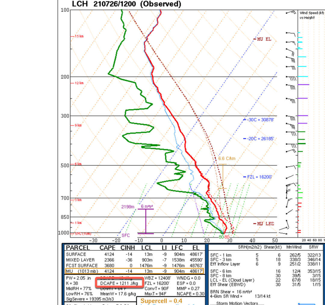
The sounding chart below from the Storm Prediction Center’s website shows a 12Z sounding at Lake Charles, Louisiana, on July 26, 2021. This area is prone to summer thunderstorms and the value of CAPE shown in this chart, on the order of 3000-4000 J/kg indicates a high potential for severe thunderstorms. Note the highlighted value for DCAPE, 1211 J/kg. Any thunderstorms forming in this atmosphere will have the potential for damaging downdrafts and straight-line winds.
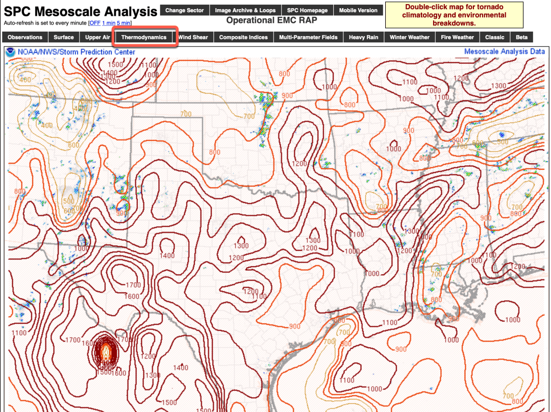
Maps (below) with overlays of DCAPE are available from NOAA’s Storm Prediction Center Mesoscale Analysis Pages. Select the grid on the map that corresponds to the region you are interested in. Above the surface analysis chart that appears, select Downdraft CAPE from the menu revealed by clicking the Thermodynamics tab (highlighted in red) and a plot similar to that below will appear.
Just as CAPE values are an important indicator of the potential for thunderstorms that should be in every weather observer’s toolkit, so, too, is DCAPE. Keep in mind that, as with CAPE, high DCAPE values are an indicator of downdraft potential, not a predictor.
What goes up usually comes down, often to great destructive effect. When studying weather conditions for your area of interest, don’t overlook Downdraft CAPE.