Bomb Cyclones
The bomb cyclone is a catchy name for a low pressure phenomenon.

There’s nothing the media likes more than a catchy phrase they can latch on to. This week, they fell in love with two terms—atmospheric river and bomb cyclone. We’ve covered atmospheric rivers elsewhere, so today let’s look at the bomb cyclone.
 Keith R Thompson, WeatherHawks
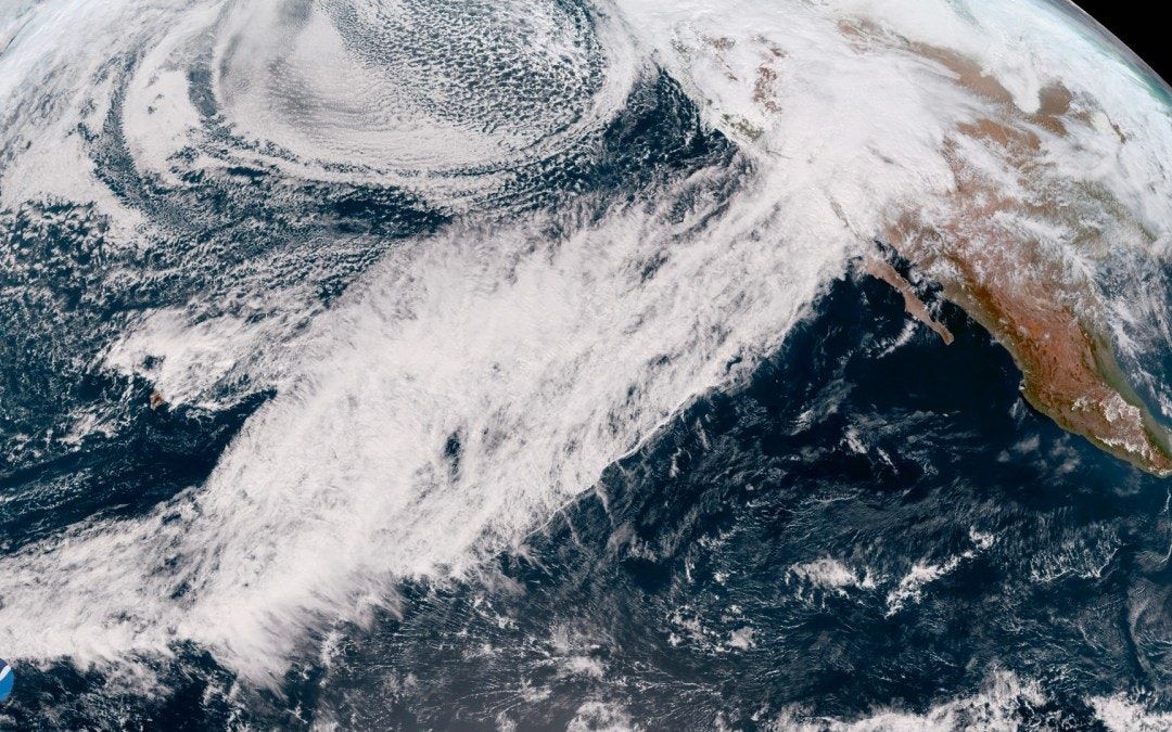
The term bomb cyclone was codified in meteorological terms by MIT professor Fred Sanders, based on previous work by Tor Bergeron, who described it in a 1980 article as an extratropical cyclone whose pressure drops 24 millibars in 24 hours. The term bombogenesis was coined to describe the process. These rapidly deepening cyclones, sometimes referred to as explosive cyclogenesis, can be characterized by high winds and fierce precipitation. Despite the media’s obsession with the term, a bomb cyclone is really nothing fancier than a rapidly deepening area of low pressure with cyclonic rotation.
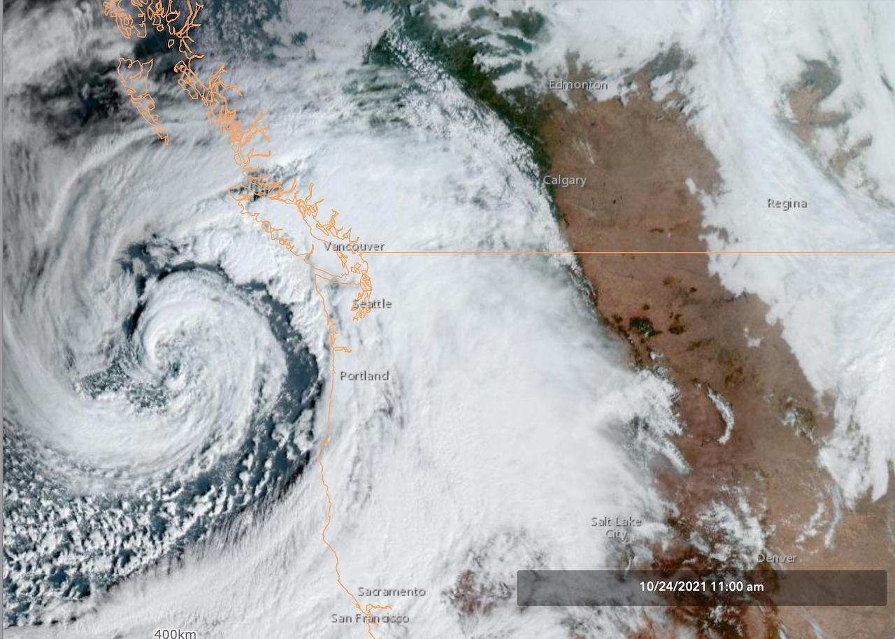
The bomb cyclone which affected California during the weekend of October 22-25 formed in the Pacific Ocean a few hundred miles northwest of Washington state, deepened rapidly, and was very well defined by Sunday, October 24th (Fig. 1).
What made this storm so potent was the presence of an atmospheric river of deep moisture approaching the California coast at the same time. This saturated air was caught up in the southern quadrant of the cyclone’s counterclockwise rotation and propelled into the northwest coast of the US. All day Sunday into Sunday evening, California experienced high winds, flash flooding and debris flows around burn scars, and heavy wet snow in the Sierra Nevada mountains around Lake Tahoe. Two people were killed.
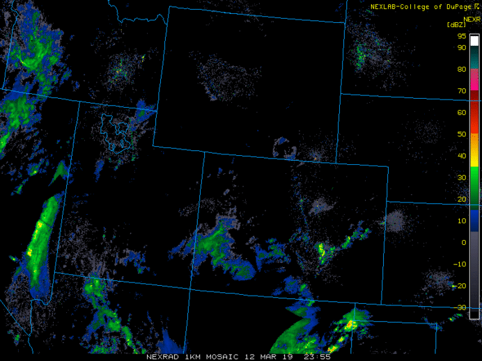
Another bomb cyclone formed over Lamar, Colorado on March 13th, 2019, bringing blizzard conditions over most of the northeastern part of the state. Nearly 1400 flights were cancelled at Denver International Airport, stranding 5000 passengers, and closing almost all major highways in the area. Hundreds of cars were stranded and abandoned as snow drifts blocked roads. Mountain areas received 1 to 3 feet of snow, with Wolf Creek Pass getting 52 inches.
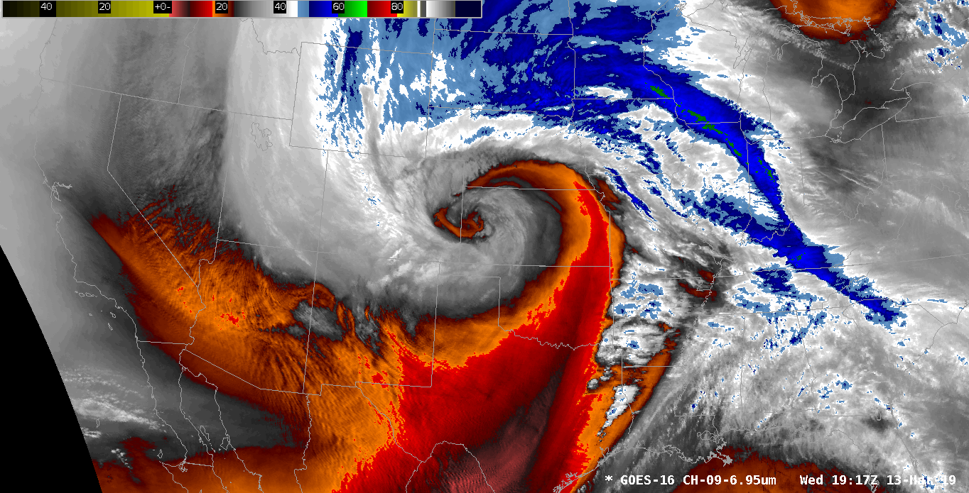
During this event, Colorado Springs Airport recorded its highest gust on record, 96 miles per hour, and DIA recorded an 80 mph gust, its second highest. The lowest recorded pressure, over Lamar, was 970.4 hPa, the lowest state pressure ever recorded outside of a tornado, according to the NWS Forecast Office in Pueblo.
Bomb cyclones occur primarily in four active regions—the Northwest Pacific, the North Atlantic, the Southwest Pacific. and the South Atlantic. As we saw with the 2019 Colorado event, they can also form over continental regions.
Bomb cyclones sound impressive and they are, but remember they are just low pressure areas (cyclones) in which the pressure drops at least 24 millibars in 24 hours. They can be phenomenal weather generators and cause major disruptions. While not common, the US has experienced two in less than three years.