Atmospheric rivers
These moisture-laden upper air flows can play an important, sometimes devastating, role.

Atmospheric rivers are getting plenty of attention from meteorologists these days and for good reason—they heavily influence the amount of moisture that reaches the western regions of the United States. NOAA describes atmospheric rivers as:
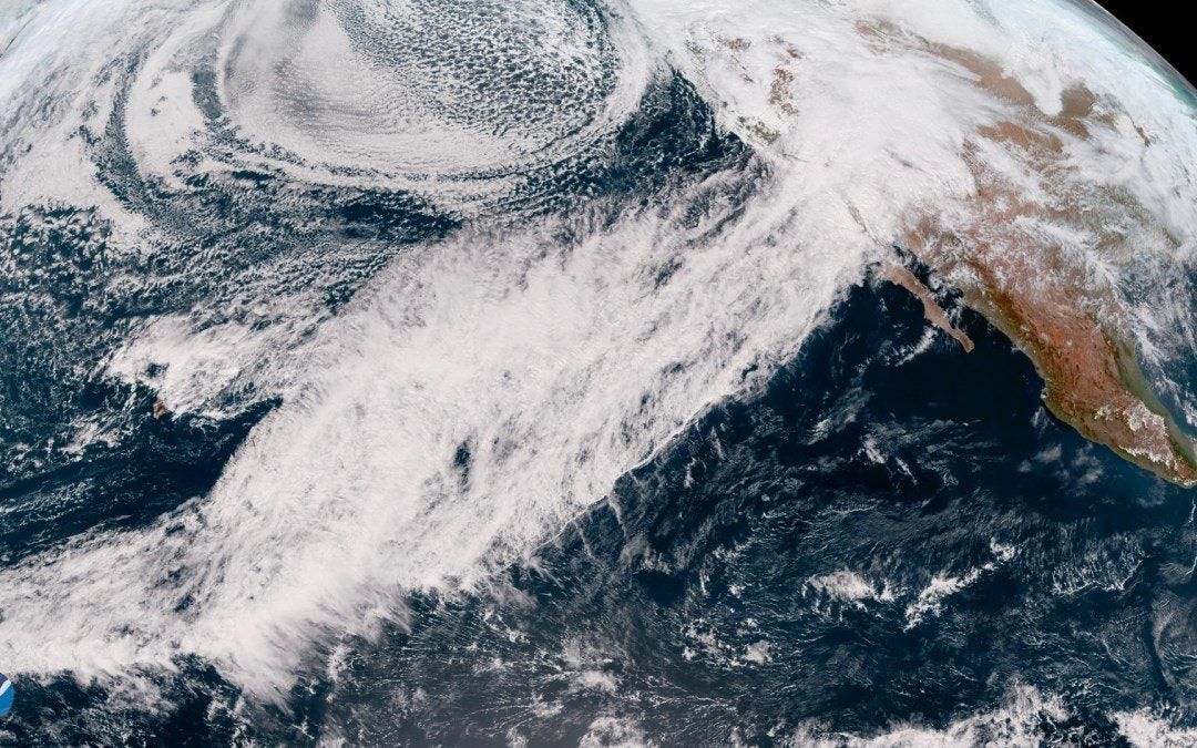
“…relatively long, narrow regions in the atmosphere – like rivers in the sky – that transport most of the water vapor outside of the tropics. These columns of vapor move with the weather, carrying an amount of water vapor roughly equivalent to the average flow of water at the mouth of the Mississippi River. When the atmospheric rivers make landfall, they often release this water vapor in the form of rain or snow.”
A study released in 2019 found that atmospheric rivers caused 84% of the flood damage suffered in eleven western states over forty years through 2017. The report estimated the annual cost at $1.1 billion. A study in 2016 found that atmospheric river events were 2.5 times more likely to produce rain or snow events, or rain falling on existing Sierra snowpack.

The Atmospheric River Portal on NOAA’s Physical Sciences Laboratory web site, lists the following Quick Facts regarding atmospheric rivers:
- On average, about 30-50% of annual precipitation in the west coast states occurs in just a few AR events, thus contributing to water supply.
- ARs move with the weather and are present somewhere on the Earth at any given time.
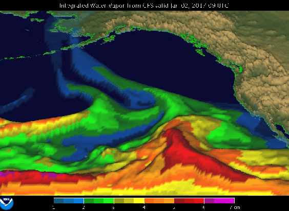
- A strong AR transports an amount of water vapor roughly equivalent to 7.5–15 times the average flow of liquid water at the mouth of the Mississippi River.
- A well-known example of a type of strong AR that can hit the U.S. West Coast is the “Pineapple Express,” due to their apparent ability to bring moisture from the tropics near Hawaii to the U.S. west coast.
- In the strongest cases ARs can create major flooding when they make land-fall and stall over an area.
- On average, ARs are 400-600 km (250-375 miles) wide.
While atmospheric rivers can be seen with satellites, assessing their impacts over land was difficult using NOAA’s observation system. To solve the problem, scientists at NOAA’s Earth System Research Laboratory developed the atmospheric river observatory (ARO), a portable monitoring station (below) consisting of a Doppler wind profiler for measuring wind profiles and snow level aloft and a Global Positioning System receiver for measuring the column-integrated water vapor concentration.
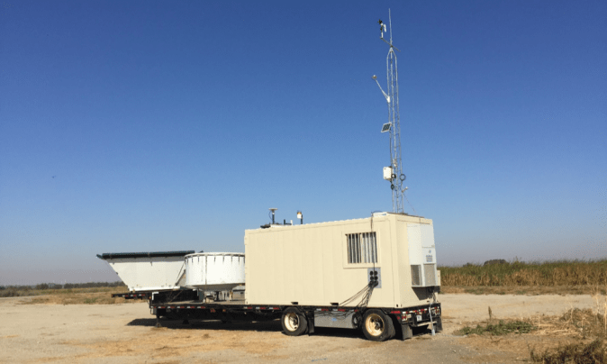
The AROs also have an S-band precipitation profiling radar and surface-based instruments to study the microphysics of the precipitation, along with a meteorological tower to monitor AR conditions near the surface. Several of these AROs are stationed at locations in California, Oregon, Washington, and well as several east coast and gulf coast states.
Scientists are beginning to realize the significance of atmospheric rivers and their sometimes disastrous impact on the western US. Many note that ARs have been less studied than hurricanes and tornados, but that’s beginning to change.