Citizen Weather Observers
There are many opportunities for citizen observers to contribute their observations.

Weather enthusiasts with an interest in contributing to the dataset that forms much of our weather backbone can find plenty of ways to contribute. In most cases, all it takes is a well-placed weather station and an internet connection through which to upload your data. Observations provided by citizen observers are used by many national meteorological agencies, including the National Weather Service, flood control and prediction centers, climatological centers, avalanche prediction centers, and others. If you’re interested in contributing to the weather observation dataset, here are several ways to do so.
Community Collaborative Rain, Hail and Snow Network (CoCoRaHS)
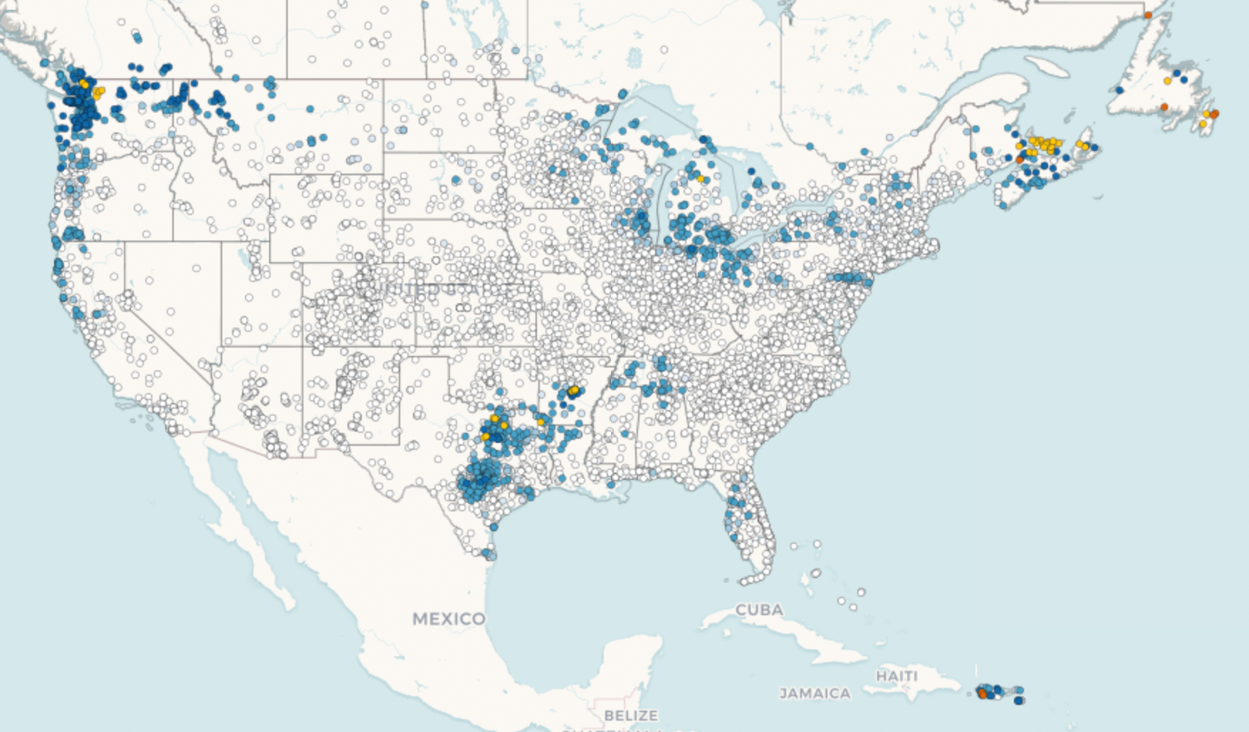
This organization is one of the largest weather observation groups in North America, with over 25,000 observers. It is one of the easiest ways to begin submitting your personal weather observations, since the only instrument needed is a standard 4” rain gauge. Participating observers are asked to read their rain gauges at or near 0700 each morning and submit their data to the CoCoRaHS website. Observations appear on an interactive national map which shows the distribution of observations and precipitation throughout the United States, southern Canada, and the Bahamas. Observers can submit reports of significant weather, occurrences of frost, snowflake configuration, snow depth, snow water equivalent, and other factors.
CoCoRaHS was organized in 1998 at the Colorado Climate Center at Colorado State University in Ft. Collins, CO, after a significant rainstorm in 1997 that resulted in five deaths from a flash flood on the west side of the city. The Weather Service was never informed of its occurrance and no warning was issued. Although intended as a local group of volunteer observers, CoCoRaHS has grown to encompass most of northern North America and is beginning to take root in Europe.
The CoCoRaHS website is an excellent starting point to learn about the organization, enroll as an observer, and obtain a rain gauge. The site and its YouTube channel have excellent training videos and slide shows to enable new observers to get off on the right foot. County volunteer coordinators are also available to help new observers and to answer questions about siting their station or contributing their data. Interested observers can also register to attend frequent online webinars where experts discuss different aspects of meteorological phenomena.
If you’re interested in learning more, or signing up as an observer, visit their website at www.cocorahs.org.
Citizen Weather Observer Program (CWOP)
The CWOP program grew out of a group of ham radio operators with an interest in weather and in submitting their observations, since many ham radio operators operated their own weather stations and wanted a way to contribute. Today ham radio operators, along with regular non-ham citizen observers, comprise over 7,000 stations contributing between 50,000 and 70,000 observations hourly.
Every five minutes, these observations are sent to the NOAA MADIS (Meteorological Assimilation Data Ingest System) server, where the data undergoes quality checking and then is distributed to users. These observations are used by over 800 different organizations, ranging from the National Weather Service Forecast Offices to the National Center for Environmental Prediction and the Department of Homeland Security. More information is available from their website at www.wxqa.com.
Cooperative Observer Program (COOP)
The Cooperative Observer Program is organized and managed by the National Weather Service Forecast Office responsible for the area in which the COOP station is located.
The COOP was formally created in 1890 under the Organic Act. Its mission is two-fold:
- To provide observational meteorological data, usually consisting of daily maximum and minimum temperatures, snowfall, and 24-hour precipitation totals, required to define the climate of the United States and to help measure long-term climate changes;
- to provide observational meteorological data in near real-time to support forecast, warning and other public service programs of the NWS.
A cooperative station is a site where observations are taken or other services rendered by volunteers or contractors. Observers are not required to take any tests. Automatic observing stations are considered cooperative stations if their observed data are used for services which otherwise would be provided by cooperative observers. A cooperative station may be collocated with other types of observing stations such as standard observations stations, Flight Service Stations, etc. In these cases, that portion of the station observing program supporting the cooperative program's mission is treated and documented independently of the other observational and service programs.
The COOP program may be comprised of observers operating their own equipment, stations provided equipment owned by the NWS, or provided by private organizations or companies. Generally, the NWS will approve a site for a COOP station based on need in the area, the suitability of the site, and the willingness of the observer to fulfill the requirements of daily observations.
If you are interested in becoming a COOP observer, contact your local National Weather Service Forecast Office. More information is available at the COOP website here.
Weather Underground Personal Weather Station Program
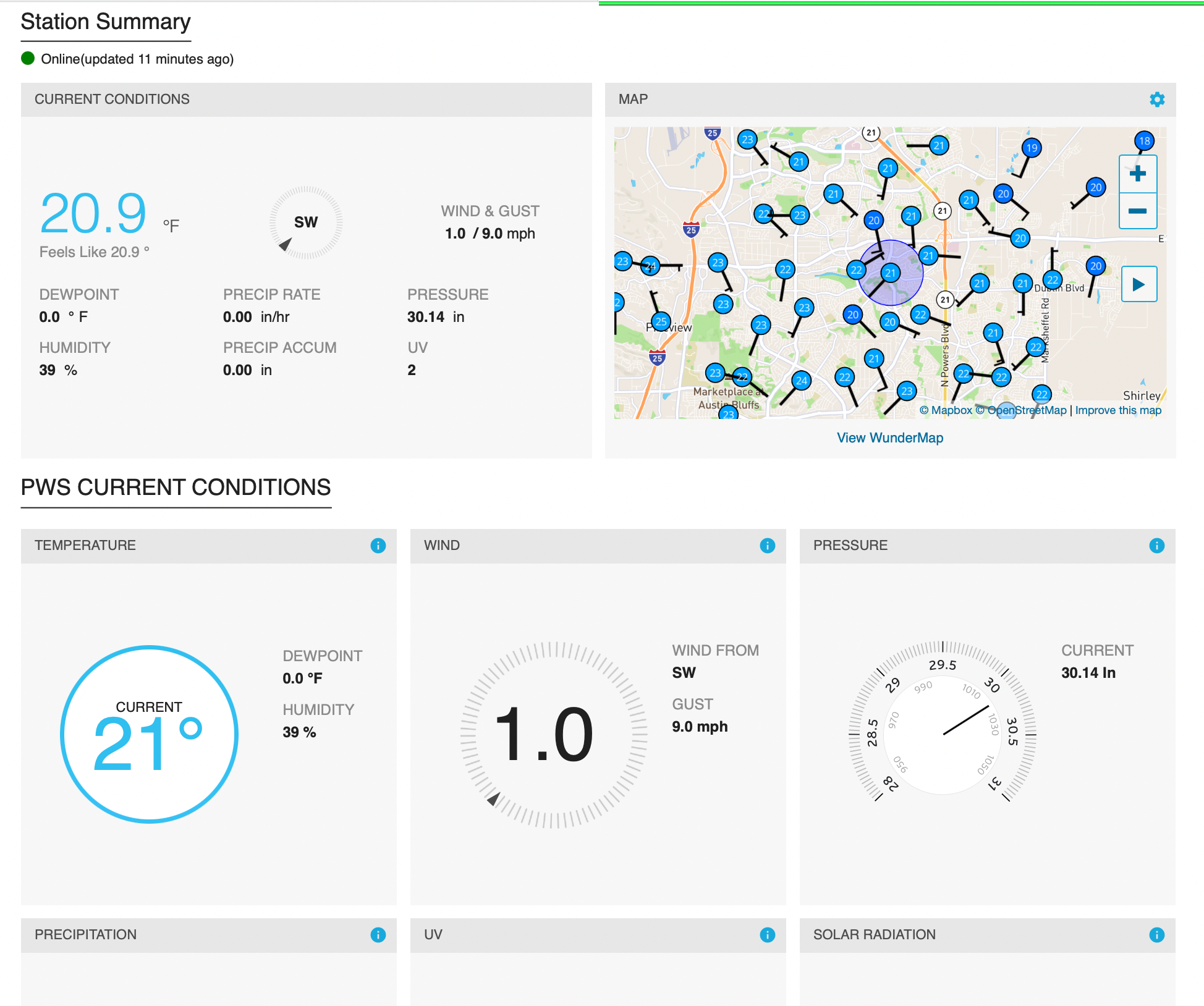
Weather Underground boasts 250,000 personal weather stations tied into their website with real-time reporting and data display. Stations must have the ability to report observations to Weather Underground via an internet connection.
Once a weather station is purchased, installed, and connected to the internet, the next step is to register the site with Weather Underground. The station make and model are selected from a drop-down list of devices, then the station owner's address is entered to pinpoint the location of the station. Next, details about the station, such as the type of surface (grass, asphalt) the station is mounted on, its elevation, and height above the ground are entered.
Once this is submitted, your station will be registered, receive an identifier and a station key. After the station key is entered into the station's software, observations will be reported at an interval you set and your station will appear online. A search for the station's identifier will bring up a web page with graphs and charts detailing the data as reported by your station. An interactive map will allow you to select nearby stations to compare your data with theirs.
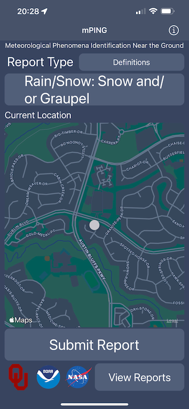
mPING
The mPING program stands for Meteorological Phenomena Identification Near the Ground and is a crowdsourcing method of gathering weather reports in real time. mPING was deployed in 2012 and was developed through a partnership between NOAA/National Severe Storms Laboratory, the University of Oklahoma, and the Cooperative Institute for Mesocale Meteorological Studies.
The mPING program is the simplest way to get started as a citizen observer. Consisting of a smartphone app available on Apple iPhones and Google Android phones, mPING allows an observer to quickly and easily make an anonymous observation that includes the observer’s location and the type of precipitation taking place.
mPING observations immediately go into a database at the National Severe Storms Laboratory and are distributed to NWS Weather Forecast Offices throughout the country. The observation appears almost instantly at NWS forecast offices and can also be displayed in many weather radar and reporting apps. The observations are used to compare citizens’ on-the-ground observations, which are frequently below levels that radar can see, with radar data to improve weather forecasting and refine computer-based weather models.
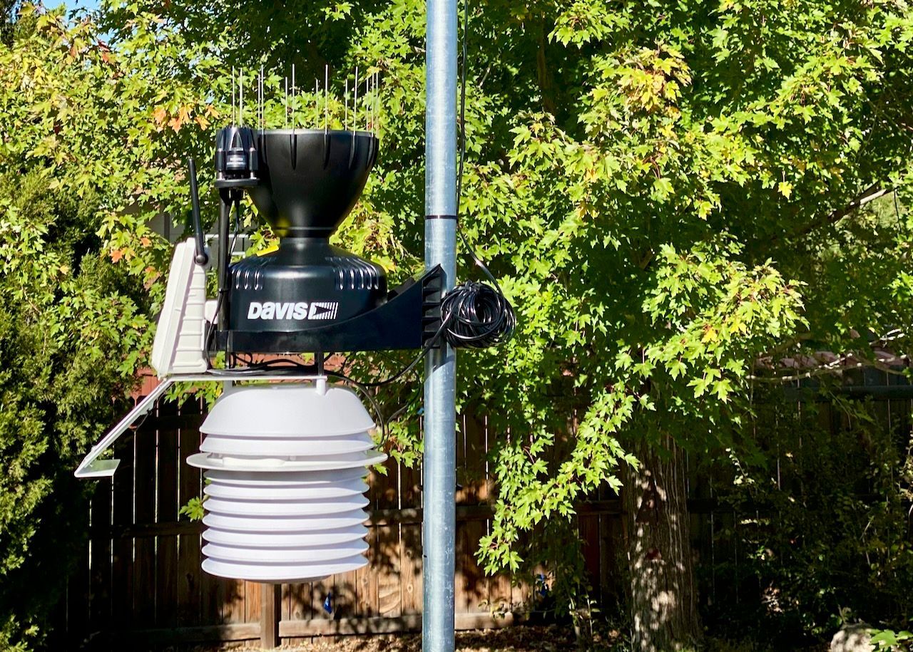
For observers using weather stations by Davis Instruments, their Weatherlink app and Weatherlink Live modems allow station observations to be uploaded to the Weatherlink web site automatically in five- or fifteen-minute intervals and then be automatically forwarded to the CWOP program, the Weather Underground Personal Weather Station site, and other supported websites. Other commercially available weather stations may offer similar capabilities.
If you’d like to contribute observations to the national weather databases, especially if you live in a relatively remote area, there are plenty of opportunities to do so. Check out the websites mentioned here and get started. It can be one of the most satisfying, educational, and important passions you can cultivate.